Tutorial

Using the Map View for Objects in APM Studio 

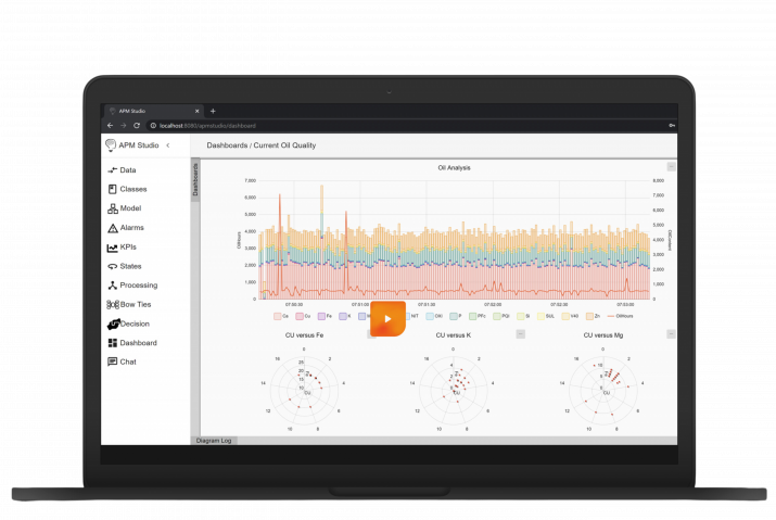
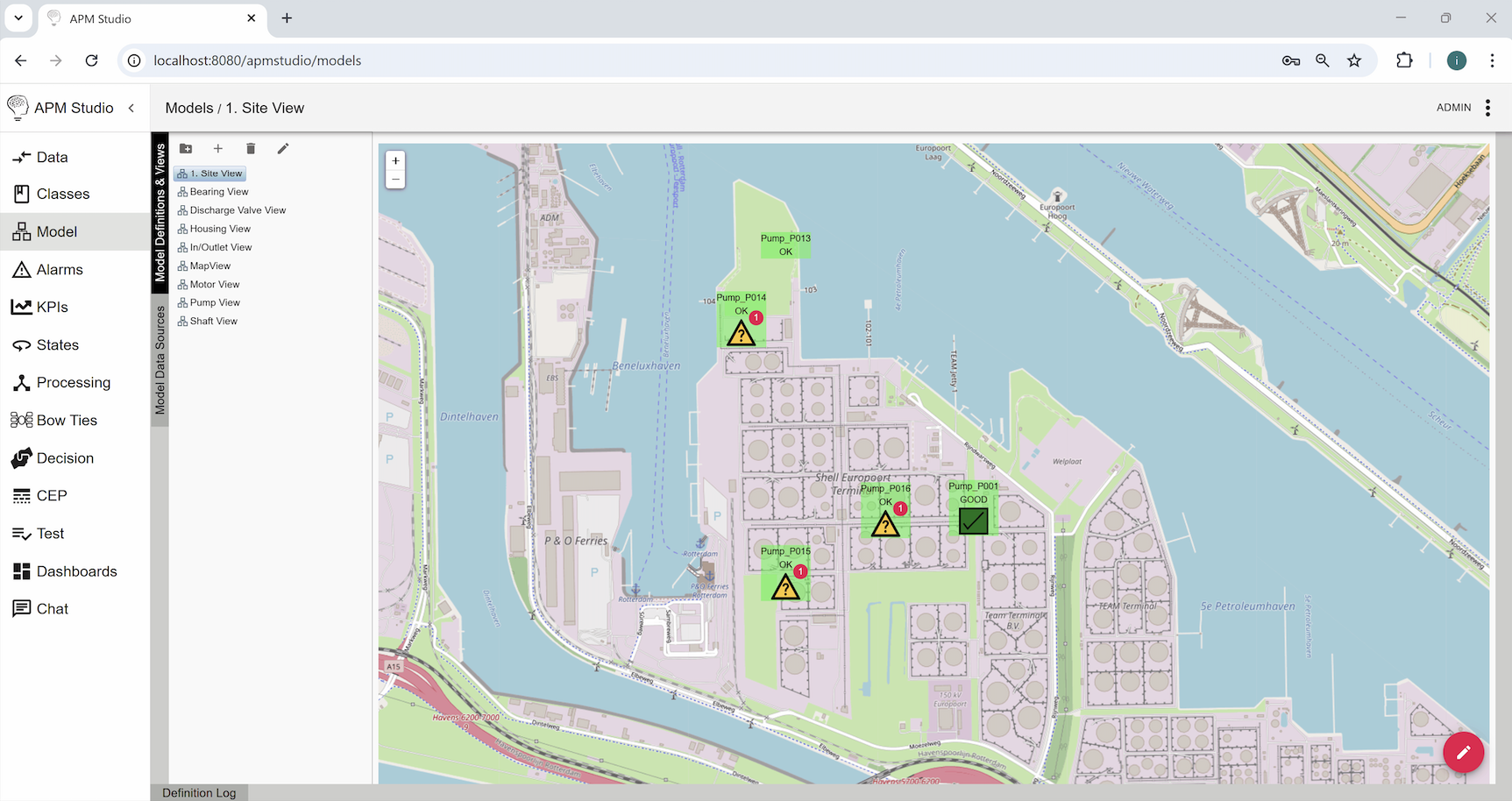
This short tutorial shows how you can use the Map View in APM Studio to visualize location and status of objects. The tutorial uses the OpenStreetMap’s standard tile layer server.


Screenshot of APM Studio interface displaying a site view map with pump locations and statuses. The left panel shows a navigation menu with options such as Data, Classes, Model, Alarms, KPIs, and more. The main screen features a detailed site map with labeled pumps (e.g., Pump_P014, Pump_P016, Pump_P001), some marked with warning symbols and status indicators (OK, GOOD, or alerts). The interface includes a toolbar for model definitions and views, with a hierarchical list of model components.

Screenshot of APM Studio interface displaying the 'Model View Configuration' settings for 'Site View'. The left panel contains a navigation menu with sections like Data, Classes, Model, Alarms, KPIs, and more. The main panel shows configurable options such as General Configuration, Model Query Configuration, and Map View Configuration.

Screenshot of APM Studio interface displaying detailed information for 'Pump_P016 (Pump_Unit)'. A pop-up window is open, showing multiple tabs including 'Overview', 'Alarms', 'Charts', 'KPI Status', and 'Location'. The 'Overview' tab is selected, listing various properties and their values such as cavitation, clogging, corrosion, flow rate, head level, health percentage, efficiency, energy, and location coordinates. The left panel contains a navigation menu with sections like Data, Classes, Model, Alarms, KPIs, and more.
Click on the images to view them in full resolution.

The tutorial shows: 

  1. How objects on the OpenStreetMap are visualized;
  2. The configuration of the APM Studio system preference for maps; and
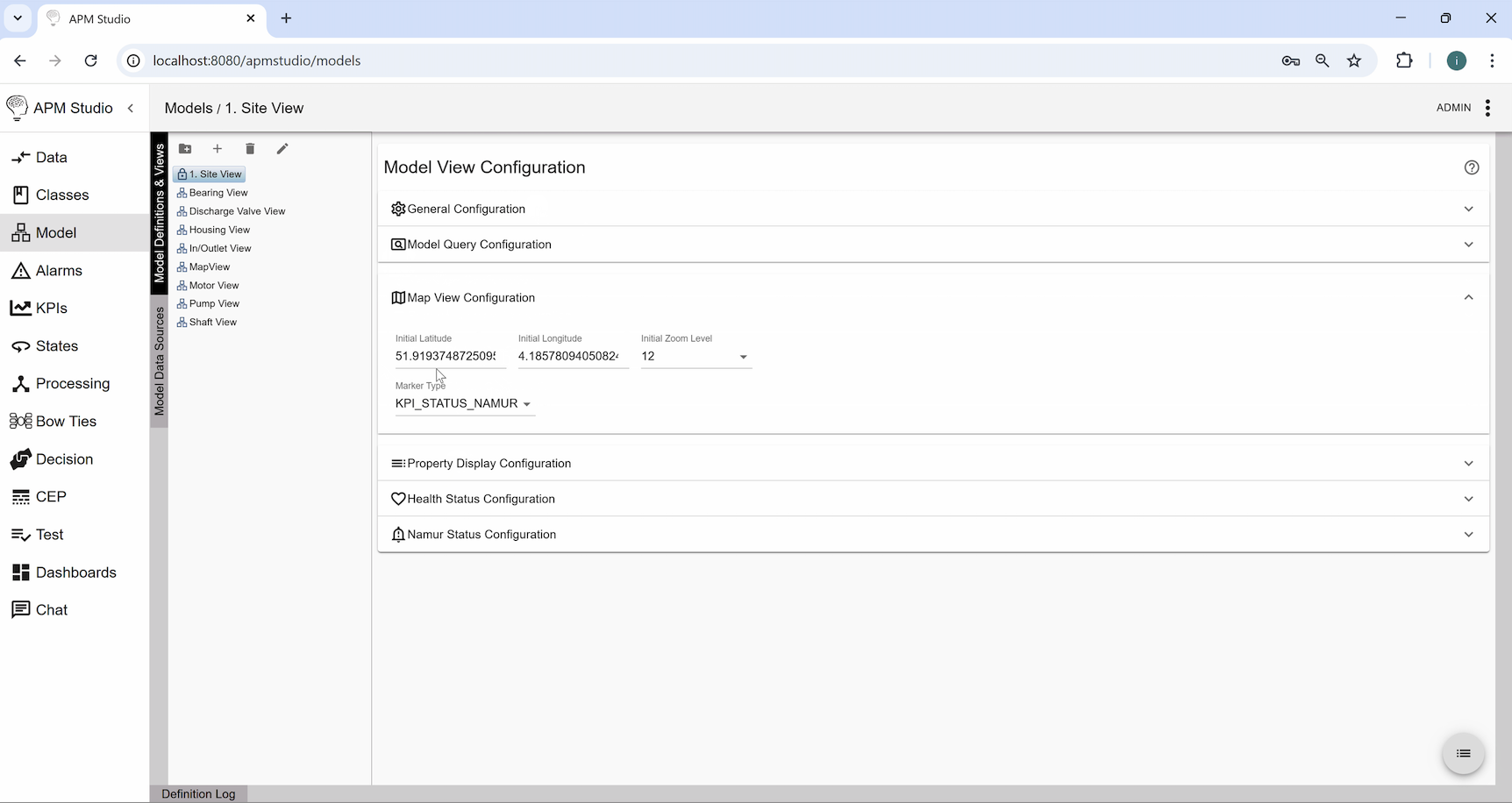
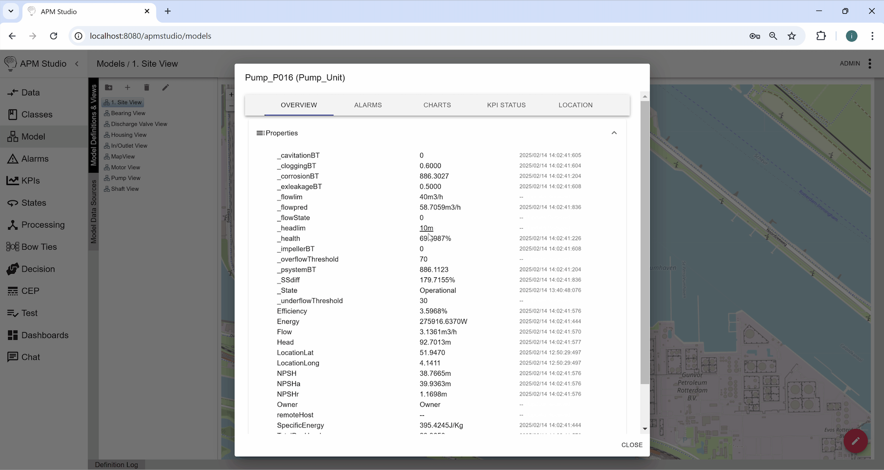
  3. The configuration of the APM Studio Model View.


Background information

OpenStreetMap (OSM) is a free, collaborative, and open-source mapping project that provides geographic data and maps to anyone who wants to use them. It is often referred to as the “Wikipedia of maps” because it relies on contributions from volunteers worldwide to create and update map data.


Key Features of OpenStreetMap:

  • User-Generated Data: Anyone can edit and update the map using GPS devices, aerial imagery, and local knowledge.
  • Free to Use: Unlike Google Maps, OSM is open-source, meaning its data is free for personal, commercial, and academic use.
  • Highly Detailed: Covers everything from roads and buildings to hiking trails and bike lanes.
  • Customizable: Developers can use OSM data to create custom maps and applications.
  • Global Coverage: Available for almost every country in the world.

OpenStreetMap data is free to use, their tile servers are not (see https://operations.osmfoundation.org/policies/tiles/). A limited number of calls were used to show the tutorial. Typically for our customers we set up a private tile server to fullfill their map visualisation needs.

Related Articles